


Mapping out history of Hexi Corridor for future


In a significant stride toward heritage preservation, Zhangye in Northwest China's Gansu province has embarked on the "Two Lines Mapping" project to safeguard its cultural relics.
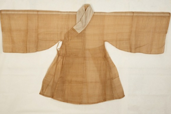
Zhangye, historically known as Ganzhou and located in the central part of the Hexi Corridor where the Qinghai-Tibet Plateau and Mongolian Plateau meet, was a significant commercial hub and strategic passage on the ancient Silk Road, earning the nicknames "Golden Zhangye "and "Jiangnan north beyond the Great Wall". Jiangnan is south of the Yangtze River's lower reaches and famous for its rich local products.
Boasting a long history and rich heritage, the city was designated by the State Council as a national historical and cultural city.
According to the third national cultural relics census, the city preserves 1,270 immovable relics, including 20 national key relics. Zhangye has 262.9 kilometers of the Great Wall built in the Han Dynasty (206 BC-AD 220), the second-longest section in the province, and 550.8 km of the Great Wall built in the Ming Dynasty (1368-1644), the longest section in the province.
"The 'Two Lines Mapping' project for cultural relics ensures the relics' authenticity and integrity, playing a pivotal role in safeguarding and restoring their historical appearances," says Wang Xu, director of the cultural relics data information center at the Gansu provincial cultural heritage administration.
The "two lines" refer to the protection boundary line and the construction control zone line of cultural heritage protection units. The protection boundary focuses on safeguarding the relics and their immediate surroundings while the construction control zone restricts building activities outside the protection boundary to preserve the unit's safety, environment and historical appearance.
"By integrating surveying and geographic information technology into cultural relic protection, we can accurately incorporate Zhangye's heritage data into the city's land-use planning system," he says. "This provides strong data support for subsequent site investigations and building surveys."
Ongoing efforts in site surveys, grotto protection, revolutionary heritage surveys and historical building assessments will enhance the protection and preservation of cultural heritage.
On March 8, 2021, the Ministry of Natural Resources and the National Cultural Heritage Administration jointly issued a guide requiring that "the spatial information of cultural heritage resources be incorporated into the national land spatial basic information platform, implementing strict protection, and establishing data sharing and dynamic maintenance mechanisms".
Based on the instructions, Zhangye developed and implemented its mapping project, which helped in the preservation of the cultural relics in the past four years.
"This project not only raises awareness about cultural relic protection but also legally ensures the preservation of the relics and their surrounding environments," says Bian Yuan, director of the Zhangye cultural heritage bureau.
Since the project's inception, the Zhangye government has prioritized its implementation.
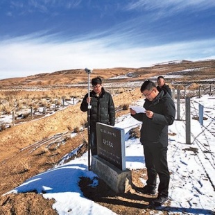
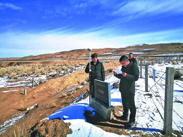
"In Gaotai, we have a special team with select skilled personnel and are collaborating with surveying departments," says Xun Defei from the Gaotai county bureau of culture, sports, radio, television and tourism.
"We use fundamental data and land survey information, employing drone aerial surveys and Global Navigation Satellite System positioning devices for on-site investigations," he says.
The office work involves overlaying protection boundary data and construction control zone data onto imagery, and creating specialized maps. These outcomes support future site investigations and grotto protection work, he says.
With the concerted efforts of the local cultural heritage and natural resources departments, Zhangye has completed the "Two Lines Mapping "for national and provincial key cultural relics. The data has been integrated into the city's "One Map "system for land-use planning. The city aims to complete the mapping for all ungraded immovable cultural relics by the end of this year, Bian adds.