


Decoding the sands of time


Taklamakan Desert slowly gives up its secrets as census takers tackle unforgiving environment, Wang Ru reports in Hotan, Xinjiang Uygur autonomous region.
The Taklamakan Desert, China's largest desert and located in the Xinjiang Uygur autonomous region, was once the central stage for numerous legends along the ancient Silk Road. However, as environmental conditions changed, the once-thriving human settlements were abandoned, standing in the wilderness with only sand and wind as companions. It wasn't until the late 19th century when foreign explorers ventured into the desert that people began to uncover many of the cultural heritage sites.
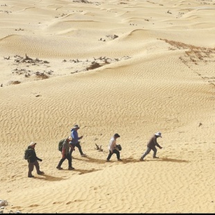
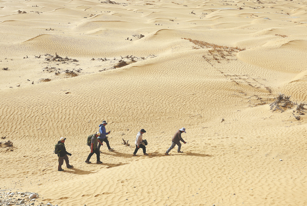
After more than a century, professionals are visiting these sites one by one. They tread on the sand, braving the strong winds and enduring the scorching sun overhead, as they strive to investigate and document their conditions.
They come from a special team of the fourth national census of cultural relics in China, which records the cultural heritage in the Taklamakan Desert, especially in its heartland.
"Many of the sites lie deep in the heart of the desert, inaccessible by regular vehicles like those used by other census teams," says Hu Xingjun, head of the team, who is also a researcher at the Xinjiang Institute of Cultural Relics and Archaeology. "We organized a special team focusing on these sites. This ensures we fulfill the census mandate of 'taking census of all those that should be covered'."
The national census began in 2023 and will end next year. Field investigations started in May last year in Xinjiang. Census takers visit the sites to survey and map them using real-time kinematic devices, take aerial photos with drones and other photos recording details, measure the size of sites, collect specimens, and record detailed information in the census database.
With more than a dozen members, the team's work has started recently and will run until the end of May.
Team members must repeatedly enter the desert, often for several days or even weeks at a time. They usually invite experienced drivers to form a fleet of sport utility vehicles stocked with fuel, food and water, equipment and daily necessities to enter the desert's depopulated zones, rest in tents, and survey each site firsthand.