China launches Zhangheng 1B Satellite for geophysical monitoring


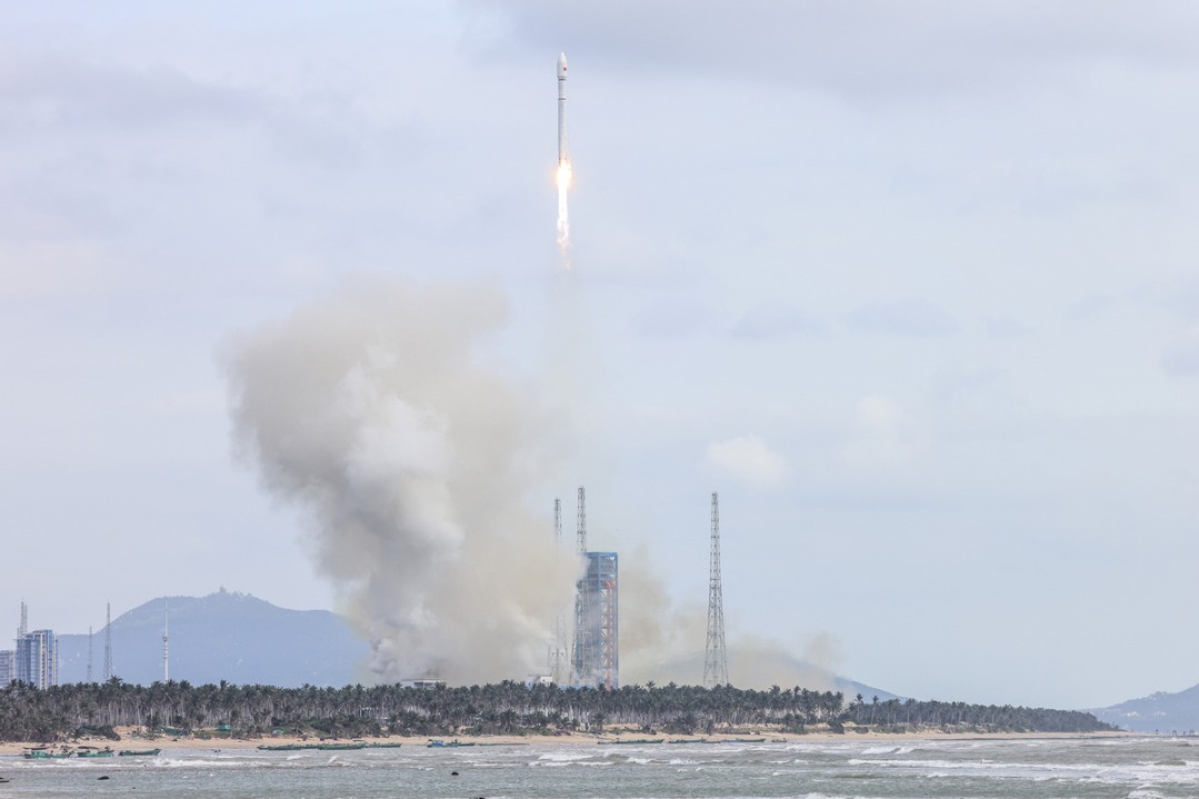
China launched a Long March 2D carrier rocket on Saturday afternoon from the Jiuquan Satellite Launch Center in its northwestern Gobi Desert, sending an electromagnetic monitoring satellite into space, according to the China National Space Administration.
The rocket blasted off at 3:56 pm and soon placed the Zhangheng 1B, the first Chinese satellite dedicated to surveying Earth's geophysical fields, into its predetermined orbit, marking the success of the launch mission, the administration said in a news release.
The satellite's deployment represents the latest achievement in enhancing the country's space-based geophysical field observation capability and will further strengthen its space-air-ground integrated monitoring ability for major natural disasters, it noted.
The administration said that the Zhangheng 1B is the result of a cooperation memorandum of understanding signed between China and Italy in 2019.
Designed with a six-year lifespan, the satellite carries nine scientific payloads, including an electric field detector co-developed by China and Italy, and a high-energy particle detector developed by Italy.
The spacecraft will conduct near real-time measurement of global electromagnetic fields, electromagnetic waves, the ionosphere and the neutral atmosphere. It will also capture electromagnetic anomalies caused by geological and human activities, as well as information on thunderstorms and lightning activities in the atmosphere.
This will effectively enhance China's capabilities for early detection, risk assessment, and early warning of massive natural disasters such as earthquakes, tsunamis, volcanic activities and thunderstorms.
Moreover, the satellite will provide data support for emergency management, natural resource mapping, and communication and navigation operations, and foster scientific and technological cooperation in related fields among countries involved in the Belt and Road Initiative, according to the release.
The Zhangheng 1A satellite was launched in February 2018 and remains operational in orbit. Also known as China Seismo-Electromagnetic Satellite, it carries six instruments to measure the electromagnetic effects of earthquakes all over the world.
The Zhangheng 1B is based on the technical configuration of its predecessor but features optimized payloads and can measure a broader set of physical parameters. Operating in different phases within the same orbital plane, the two satellites will conduct coordinated observations, effectively improving the spatio-temporal resolution of observations and allowing them to better fulfill their tasks, designers said.


- Cross-talk performance at Great Wall in Tianjin attracts over 1,500 spectators
- China sees rise in influenza, rhinovirus, and other respiratory infectious diseases
- Zhang Chaoyang emphasized active thinking in AI era
- CIIE concludes with record-high intended deals
- Lhasa's GDP grows 7.1 percent in first three quarters of 2025
- Co-hosting games boosts GBA integration