China launches remote sensing satellites SuperView-1 03/04


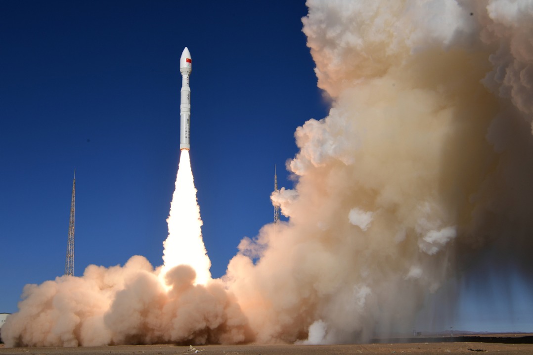
TAIYUAN -- China launched a pair of 0.5-meter high-resolution remote sensing satellites Tuesday from the Taiyuan Satellite Launch Center in north China's Shanxi Province.
The satellites, SuperView-1 03/04, blasted off at 11:24 a.m. Beijing time on the back of a Long March 2D rocket, according to the center.
The mission aims to promote the country's commercial use of high-resolution remote sensing satellites.
The satellites, which are able to provide commercial images at 0.5-meter resolution, are expected to offer remote sensing data to customers worldwide and provide services to land and resource surveys, mapping, environmental monitoring, finance and insurance as well as the Internet industry.
The satellites were developed by China Aerospace Science and Technology Corporation.
It is the second launch of the corporation's commercial remote sensing satellites, followed by the launching of SuperView-1 01/02 in December 2016.


- Eight missing after cargo ship collides with fishing vessel near Shandong
- Investing in people: a worthwhile investment
- Exhibition commemorating the epic relocation of universities opens in Fujian
- Twelve punished for scaffold collapse that killed 7 in Shandong
- Slovenian official visits whole-process people's democracy practice site of CPPCC committees
- China's commercial rocket maker puts two satellites into orbit