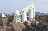
The Gaofen Earth observation satellite system has snapped more than 4 million photos over the past few years, benefiting land resource management, forest surveying, fire prevention and agricultural forecasting across China.
The Ministry of Land and Resources alone has received 695,000 images taken by the Gaofen-1 and 239,000 by the Gaofen-2 and used them to survey natural resources, locate water sources for border defense units, pinpoint disaster hazards, handle emergencies and monitor urban construction, said Fang Hongbin, a senior expert at the ministry's China Aero Geophysical Survey and Remote Sensing Center.
Each year, Fang's team receives high-definition images from 490 places covering 19 million square km. Before April 2013, when China launched the Gaofen-1 observation satellite, almost all of those photos had to be bought from foreign companies, imposing a huge cost on the ministry, he said.
"Now nearly 80 percent of the high-definition images are taken by our Gaofen satellites, which substantially reduces our financial burden and improves our work," he added.
The ministry has made 16-meter-resolution images for all of China's territories and established a database of the nation's geographical features and natural resources.
The Gaofen images have enabled border defense units in southern Xinjiang Uygur autonomous region dig 36 wells to address a water shortage. In the country's northeastern border areas, several military infrastructure projects determined suitable locations through analysis of Gaofen satellite-taken pictures, Fang said.
With the system's assistance, inspectors found several unapproved mining sites in Hunan's Hengyan area and more than 1,000 places in southwestern China that were likely to be struck by natural disasters.
Gaofen satellites have also helped with relief efforts after disasters, including the 2013 Changdu earthquake in Tibet autonomous region and the recent landslide in Shenzhen, Guangdong province, Fang said.
The ministry's law enforcement units now use high-definition images to monitor local governments' land usage, he said.
Currently, 21 provincial-level regions have set up a Gaofen data applications center to receive and distribute images and data generated by the satellites, according to the State Administration of Science, Technology and Industry for National Defense.
By the end of November, Gaofen-1 and Gaofen-2 had generated more than 4 million images that have been used by 1,100 government departments, institutes and companies in 18 sectors, the administration reported.
Huang Guosheng, a researcher at the State Forestry Administration, said forestry authorities have greatly benefitted from the use of Gaofen images.
"The satellites have enabled us to monitor forests in a timely manner and find forest fires as well as unapproved timber cuttings soon after they take place," he said.
In the agricultural sector, Gaofen satellites reduce local government reliance on foreign satellite images in estimating harvests, forecasting droughts and floods, and forecasting plant disease and pest control, said Zhang Haitao, a publicity officer at agriculture ministry.
Copyright 1995 - . All rights reserved. The content (including but not limited to text, photo, multimedia information, etc) published in this site belongs to China Daily Information Co (CDIC). Without written authorization from CDIC, such content shall not be republished or used in any form. Note: Browsers with 1024*768 or higher resolution are suggested for this site.
License for publishing multimedia online 0108263 Registration Number: 130349 ![]()