-
News >China

Flood risk map in the works
2010-09-07 07:56BEIJING - Chinese authorities are drawing up a national flood risk map in a bid to boost disaster control as China has been hit by the worst flooding in a decade this year.
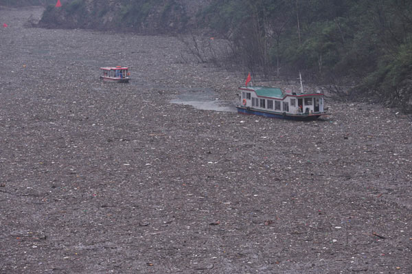 Passenger liners inch along on a lake formed by landslides in Beichuan, Sichuan province, on Sunday. Torrential rain has dumped tons of garbage and floating materials into the lake. [Wu Chuanming / for China Daily]
The map, expected to be completed by 2022, will help the country set up a risk rating system for floods and improve measures to manage human activity in danger-prone regions, said Xiang Liyun, deputy director of the department of water hazard research under the China Institute of Water Resources and Hydropower Research.
The country has witnessed severe flooding this year, with 3,185 dead, 1,067 missing and 230 million affected in flood-related disasters as of Aug 31, according to the latest statistics from the Ministry of Civil Affairs.The floods have caused crop failure in 2.66 million hectares of farmland and the collapse of 2.11 million houses, with direct economic losses of more than 350 billion yuan ($51 billion).
The flooding has made this the worst year in 10 years for flooding, Xiang told the Outlook Weekly under the Xinhua News Agency.
"The flood risk map will limit human development according to risk ratings and avoid potential casualties and economic losses in city planning," Xiang said.
Potential flood risk regions are being classified into categories such as development-forbidden zones and development-limited zones, to guide local economic development and play an important role in flood prevention, he said.
"City planners should take into account flood risks," and make sure buildings are constructed outside of flood-prone areas, Xiang said.
As more people move into towns and cities, avoiding possible dangers and utilizing land rationally is at the top of authorities' agenda, he said.
Pan Yue, vice-minister of environmental protection, said in April 2005 that researchers estimate that about 150 million people live in ecologically fragile locations and are at risk of being evacuated during flooding.
A devastating mudslide in Gansu province last month left at least 1,471 dead and 294 missing as of Wednesday, Xinhua reported.
Besides the flood risk map, researchers also suggested making full use of the flooding for drought relief, as the country suffers from drought and flooding in different seasons.
Pan Jiazheng, a hydrologist with the Chinese Academy of Engineering, said dams like the Three Gorges Dam can help reduce excess water by directing floods and storing part of the supply, which can be used later during droughts.
The Three Gorges Dam on the Yangtze River passed its first and largest test on July 20 by sustaining a water flow greater than the flood of 1998. The 1998 flood killed 4,150 people nationwide.
The flow of water into the dam's reservoir peaked at about 70,000 cubic meters per second in its latest test. The dam, which was completed in 2008, discharged water at about 40,000 cubic meters per second.