Chinese engineers make sci-fi drone mapping reality
Share - WeChat


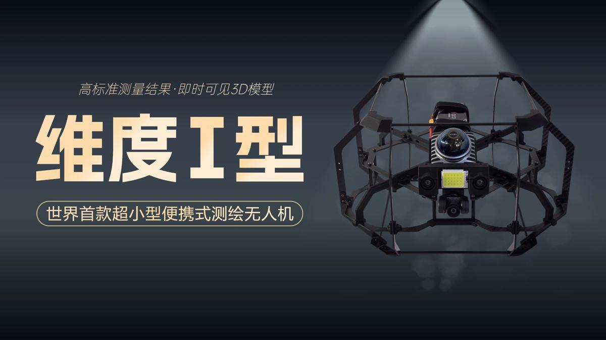
A scene from the science fiction film Prometheus, where explorers deploy a mini-drone that laser-scans caves to generate 3D models instantly, has turned into reality, thanks to the efforts of Chinese engineers.
On Tuesday, the Spatiotemporal AI Perception Technology Innovation Center at the Tianfu Jiangxi Laboratory in Chengdu, Sichuan province, announced that it has launched Dimension 1, the world's first ultra-compact portable mapping drone. It is designed to perform asset digitization scanning tasks in indoor environments.
- Guangdong urged to drive high-quality development
- Shanghai hosts 6th intl 3E talent fair
- Xi's special envoy attends inauguration of Bolivian president
- Countdown to 15th National Games: On-site warm-up entertains audience
- Eight missing after cargo ship collides with fishing vessel near Shandong
- Investing in people: a worthwhile investment


